A real-time animated map of the fleet, built straight from the data we collect. Every bus, its route and its state, updating live across the region.
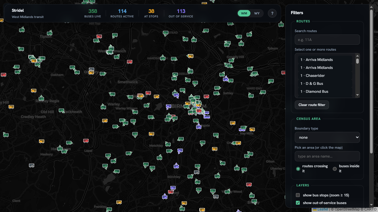
Direction-aware bus glyphs moving in real time, classified as running, dwelling, stuck in traffic, or stale.
Filter by route, tap a stop for its codes and services, and overlay census geographies.
Switch between West Midlands and West Yorkshire, each fed by its own live collection.
Built with FastAPI + Leaflet on Stridel's collection pipeline. Live above — or open it full-screen.